
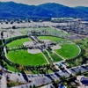
Aerial Survey in San Diego, CA
Dexknows® - helps you find the right local businesses to meet your specific needs. Search results are sorted by a combination of factors to give you a set of choices in response to your search criteria. These factors are similar to those you might use to determine which business to select from a local DexKnows directory, including proximity to where you are searching, expertise in the specific services or products you need, and comprehensive business information to help evaluate a business's suitability for you. DexKnows advertisers receive higher placement in the default ordering of search results and may appear in sponsored listings on the top, side, or bottom of the search results page.

- Neighborhoods:
- Gaslamp, Central San Diego
- Payment method:
- debit, check, paypal, cash, all major credit cards

Professional Land Surveying and Civil Engineering Services At the leading edge of Land Development Projects throughout California for the past 11 years. O
- Payment method:
- check


Our drone pilots/aerial photographers are equipped with state of the art drones and 4k cameras to capture views, angles and heights unmatched with standa
- Payment method:
- paypal, check, debit, visa, discover, mastercard, all major credit cards
- Brands:
- 4K, DJI

- Payment method:
- all major credit cards, cash, check
- Brands:
- DJI

Showing 1-9