


SKYFLEX Aerial Imagery
 15111 Metcalf Ave, Overland Park, KS 66223
We are an aerial imagery and data acquisition company. We specialize in high-end real estate marketing, aerial inspections, data analytics, and 3D mapping. Our wide range of services allows us to accommodate every project fully without the cost and complications of outsourcing. We have a certified flight instructor pilot on staff and an owner with a pilots license. We have been issued a 333 exemption from the FAA which allows us to operate lawfully and safely while we serve our clients with premier quality. Take your business to a new level; elevate your marketing to match your skill set, obtain invaluable information at a fraction of the cost, or use our services to gain a new perspective.
Looking for Aerial Surveyors in Overland Park, KS?
Answer a few questions and we’ll get you free estimates from local businesses.
Find ProsReviews
12/30/2016
Provided by YP.comGreat group of professionals with great services!! I highly recommend SKYFLEX for all your aerial imagery and 3d mapping needs.
More Business Info
Aerial Imagery & Data Acquisitions
- Hours
- Regular Hours
Mon - Sun: - Extra Phones
Derek Keene: 917-587-8165
- Services/Products
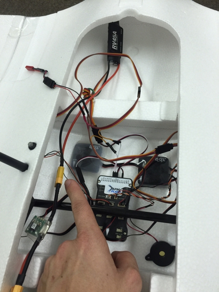
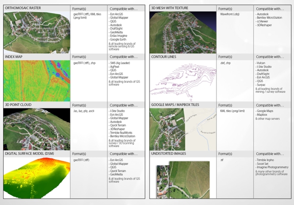
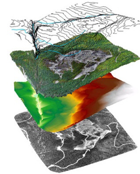
- - Real Estate Marketing - Aerial Imagery - Data Acquisition -GIS Integrations - Drone Videography - Photography - Event videography/ photography - 3D Mapping - BIM - Topography Specialties Real Estate Marketing, Aerial Imagery, Data Acquisitions, Drone Videography, Inspections, Data Processing, Disaster Relief, Emergency Response, 3D Modeling, Project Progress, Unmanned Aerial Systems, Consulting, Multi-Rotor Solutions, Fixed Wing Solutions, Heat Mapping
- Payment method
- discover, mastercard, visa, all major credit cards, check, debit, paypal, financing available, company card
- Associations
- Mississippi Asphalt Pavement Association, Aerial Forestry Services, Quinn Real Estate Company, 4U2C Productions
- Other Link
- Other Emails
- Categories
- Aerial Surveyors, Aerial Patrol & Inspection Service, Data Processing Service, Mapping-Geographic Information Systems, Video Production Services-Commercial